Innovative Landscape Architecture Techniques for Alberta’s Diverse Ecosystems

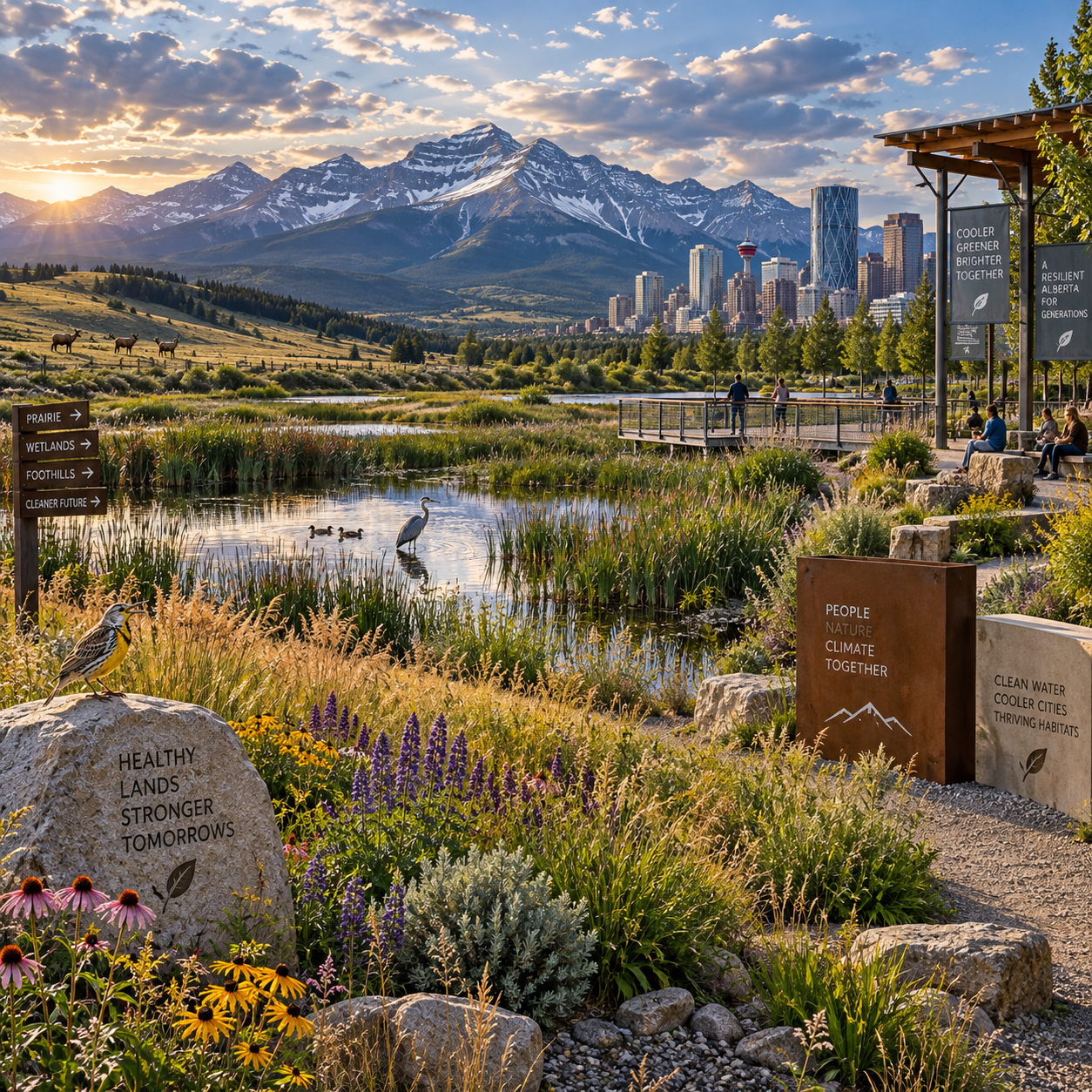
Alberta landscape architecture must respond to an unusually broad range of ecological conditions. Prairie grasslands, foothills, boreal forests, wetlands, agricultural landscapes, and growing urban centres each have different soils, water cycles, wildlife patterns, cultural histories, and climate pressures.
Innovation in this context is not limited to new technology. It includes better site analysis, native and adapted plants, low-impact development, ecological restoration, green infrastructure, and respectful collaboration with communities. The strongest projects connect environmental performance with public use, accessibility, safety, identity, and realistic long-term maintenance.
Designing for Alberta’s Ecological Diversity
Alberta’s ecological diversity requires site-specific landscape architecture rather than one universal design solution. A successful project begins by understanding the local ecosystem, hydrology, soils, climate, vegetation, wildlife movement, and patterns of human use.
The province’s grasslands face periodic drought, intense sun, wind exposure, and limited moisture. Foothill landscapes bring changing elevation, erosion risks, and transitions between prairie and forest. Boreal areas require careful treatment of woodland soils, wetlands, fire-adapted systems, and habitat continuity. Urban sites add compacted ground, heat retention, pollution, fragmented habitats, and heavy public use.
Landscape architects translate this ecological information into a practical design framework. Before selecting materials or plants, they may map drainage, identify remnant vegetation, assess invasive species, review wildfire exposure, and examine how a site connects to surrounding habitat. This process helps determine whether a project should conserve an existing system, restore a damaged one, or introduce a carefully designed hybrid landscape.
Regional character also matters. A streetscape in Calgary, a park in Edmonton, a campus near Fort McMurray, and a wetland-edge community in central Alberta may all require different grading, planting, irrigation, and maintenance strategies. Design should reflect those differences while still meeting accessibility standards, municipal requirements, and community expectations.
Climate-Responsive and Resilient Landscape Design
Climate-responsive landscape design adapts form, materials, plants, and water use to Alberta’s changing weather conditions. The goal is to create landscapes that remain safe and functional through drought, extreme cold, heavy rainfall, heat, wind, and seasonal variability.
A useful approach is to evaluate a site through four questions: where does water arrive, where does it move, where can it be stored, and which elements must remain operational during stress? This simple sequence supports decisions about grading, soil depth, planting zones, shade, drainage, and maintenance access.
- Drought: Use hydrozones, deep and well-prepared soils, mulch, efficient irrigation, and plants suited to local moisture conditions.
- Extreme temperatures: Provide wind protection, shade where appropriate, durable materials, and species with reliable winter hardiness.
- Variable precipitation: Design for both water retention and safe overflow, rather than assuming rainfall will follow historic patterns.
- Wildfire risk: Coordinate vegetation arrangement, defensible-space principles, access routes, and maintenance with local regulations and qualified specialists.
- Seasonal change: Select plants and materials that support winter interest, spring drainage, summer habitat, and fall resilience.
Resilience has trade-offs. Choosing highly drought-tolerant planting can reduce irrigation demand, but it may provide less shade during establishment or require careful weed control. A resilient landscape therefore needs an operations plan, not simply a resilient planting palette. Irrigation start-up, pruning, snow storage, inspection, replacement planting, and monitoring should be considered during design.
Landscape architects can also use scenario planning: testing how a site performs during a dry summer, a rapid snowmelt event, or an intense rainfall. This reveals weaknesses before construction and supports more defensible decisions.
Native Planting and Biodiversity-Focused Strategies
Native and adapted plants support biodiversity when they are arranged as functioning plant communities rather than isolated decorative specimens. The right palette depends on local soils, moisture, exposure, intended use, and the habitat relationships a project aims to support.
Native plants can provide food, shelter, nesting structure, and seasonal resources for pollinators and other wildlife. They may also be better aligned with regional climate conditions, although native status alone does not guarantee low maintenance or suitability for every urban site. Adapted non-invasive plants can have a role where conditions are highly altered, provided they do not displace habitat priorities.
A layered planting strategy creates greater ecological value than a single uniform groundcover. Designers can combine canopy and understory trees, shrubs, tall grasses, flowering perennials, sedges, and low-growing species. In prairie settings, diverse grass-forb communities can tolerate exposure while offering habitat. In boreal and foothill areas, woodland edges and shrub layers can help connect forest structure with open space.
- Use locally appropriate seed and plant material where available and suitable.
- Group plants by moisture, soil, and maintenance requirements.
- Include flowering periods across spring, summer, and fall.
- Protect existing mature vegetation whenever its condition and location allow.
- Remove invasive species through a planned, multi-year management program.
- Design habitat away from conflicts with paths, lighting, buildings, and high-use recreation areas.
Pollinator gardens, bird-friendly shrubs, amphibian habitat, and wildlife corridors should be connected to broader ecological systems. A small planting area can contribute to biodiversity, but connectivity often determines whether wildlife can use it effectively.
Water-Sensitive Landscape Architecture
Water-sensitive landscape architecture manages rain and snowmelt close to where they fall, while protecting buildings, paths, waterways, and downstream ecosystems. It combines low-impact development with grading, soils, vegetation, storage, filtration, and controlled release.
Rain gardens can collect runoff from roofs and paved areas, allowing water to filter through engineered soil and plant roots. Bioswales use shallow, vegetated channels to slow and direct flows. Constructed wetlands can provide storage and treatment where site conditions, regulatory requirements, and long-term maintenance support them. Permeable surfaces may reduce surface runoff, but their performance depends on correct subgrade preparation, infiltration conditions, winter management, and regular maintenance.
Good stormwater management begins with a site water budget. Designers should identify impervious areas, runoff sources, infiltration limits, seasonal groundwater conditions, snow storage, overflow routes, and receiving water bodies. A rain garden placed in the wrong soil or beside a vulnerable foundation can create problems rather than solve them.
Water conservation also includes reducing unnecessary irrigated turf, using soil amendments appropriately, specifying efficient irrigation, and selecting plants for clearly defined water zones. However, low-water landscapes still require establishment watering. Removing irrigation too quickly can cause plant failure, erosion, and replacement costs.
Landscape architects coordinate these systems with civil engineers, geotechnical professionals, municipalities, and maintenance teams. The design must remain understandable after handover: operators should know where water is intended to flow, what sediment removal is required, and which signs indicate system failure.
Restoring and Connecting Alberta’s Landscapes
Ecological restoration repairs damaged soil, vegetation, water processes, and habitat relationships while reconnecting developed areas to functioning natural systems. Restoration may involve revegetating disturbed ground, protecting wetlands, rebuilding soil structure, controlling invasive species, or re-establishing natural drainage patterns.
Soil is often the hidden starting point. Construction compaction can restrict roots, reduce infiltration, and increase runoff even when the final planting plan looks ecologically appropriate. Testing, decompaction where feasible, organic matter management, erosion control, and careful handling of salvaged soil can improve establishment.
Wetland protection deserves particular attention because wetlands store water, support biodiversity, and provide ecological functions that are difficult to replicate. Development near wetlands should consider buffers, hydrological connections, access impacts, invasive species, and construction timing. Regulatory review is essential, and avoidance is generally preferable to attempting replacement after damage occurs.
Habitat connectivity can be designed at multiple scales:
- At the site scale, use continuous planting, shelterbelts, vegetated drainage routes, and dark or quiet refuge areas.
- At the neighbourhood scale, connect parks, school grounds, utility corridors, and naturalized boulevards.
- At the regional scale, coordinate with conservation plans, river corridors, riparian systems, and protected areas.
Restoration is measured over time. Monitoring should track plant establishment, invasive species, erosion, water levels, wildlife use, and public impacts. A landscape that looks complete at handover may still need several growing seasons before its ecological performance becomes clear.
Innovative Approaches for Urban and Community Spaces
Urban landscape architecture can combine ecological performance with comfortable, accessible, and memorable public spaces. Parks, streetscapes, campuses, residential developments, and civic spaces can all function as green infrastructure when design integrates habitat, shade, water, movement, and social use.
Innovative urban strategies include tree trenches that connect soil volumes beneath pavements, multifunctional plazas that temporarily store stormwater, naturalized park edges, shaded walking routes, and streetscapes that use planting to separate people from traffic. These techniques must be detailed for snow clearing, salt exposure, utilities, sightlines, emergency access, and winter accessibility.
Public use should shape ecological design. A dense habitat area may be appropriate beside a path but unsuitable at a busy play space. Tall planting can improve habitat and reduce mowing, yet it may create concerns about visibility or perceived safety. Clear edges, strategic openings, lighting design, and maintenance standards can resolve some of these tensions.
Universal accessibility belongs in the ecological conversation. Firm, stable routes, rest areas, readable wayfinding, appropriate grades, and varied sensory experiences allow more people to benefit from naturalized spaces. Community identity can emerge through local materials, seasonal planting, art, interpretive elements, and stories developed with residents.
Innovation should be judged by performance across several years, not by visual novelty at opening day. A simple, maintainable rain garden may outperform a complex system that operators cannot inspect or repair.
Professional Collaboration and Stewardship
Landscape architects lead coordination among ecological, technical, cultural, and public priorities. They work with municipalities, engineers, ecologists, planners, architects, contractors, Indigenous communities, landowners, maintenance staff, and residents to turn site knowledge into responsible action.
Early collaboration improves outcomes because many critical decisions occur before the landscape plan is finalized. Civil engineering affects drainage. Architecture affects shade and wind. Transportation planning affects habitat fragmentation and pedestrian safety. Maintenance teams understand operational constraints that may not be visible during design.
Indigenous and place-based knowledge must be approached through respectful, project-specific relationships. Landscape professionals should avoid treating Indigenous knowledge as a generic design resource or speaking on behalf of Indigenous communities. Engagement should involve appropriate representatives, permissions, compensation, cultural protocols, and clarity about how knowledge may be used. Place-based knowledge can enrich understanding of seasonal change, water, plants, land relationships, and cultural meaning when collaboration is invited and properly supported.
A practical stewardship framework has five parts:
- Observe: document ecological and community conditions before intervention.
- Design: select strategies suited to the site rather than applying a template.
- Deliver: protect soils, plants, water systems, and habitat during construction.
- Maintain: provide clear standards, training, inspections, and adaptive management.
- Learn: monitor performance and adjust the landscape as conditions change.
For Alberta projects, this stewardship mindset provides a durable measure of professional quality. Qualified landscape architecture professionals can help clients balance ecological restoration, biodiversity, climate resilience, public value, regulatory context, and long-term care without reducing complex landscapes to a single performance claim.
Frequently Asked Questions
What makes landscape architecture suitable for Alberta’s different ecosystems?
Landscape architecture combines site analysis, planting design, grading, water management, public-realm planning, and stewardship. This allows each project to respond to local prairie, foothill, boreal, wetland, or urban conditions.
Which native plants and planting strategies support biodiversity?
Suitable choices depend on region, soil, moisture, exposure, and intended habitat. Layered communities of locally appropriate grasses, sedges, shrubs, trees, and flowering plants generally provide more ecological value than uniform planting.
How can landscape design improve stormwater management?
Rain gardens, bioswales, constructed wetlands, permeable surfaces, soil improvement, and well-planned grading can slow, store, filter, infiltrate, and safely convey runoff. Each technique requires site testing and a maintenance plan.
What techniques help landscapes withstand drought and extreme weather?
Use hydrozoning, deep soils, efficient irrigation, mulch, shade, wind protection, hardy native or adapted plants, safe overflow routes, and flexible maintenance practices. Design should account for both dry periods and intense precipitation.
How do landscape architects incorporate Indigenous and place-based knowledge?
They build respectful relationships with appropriate Indigenous communities and knowledge holders, follow agreed cultural protocols, secure permissions, and clarify how knowledge will be represented. Collaboration should be specific to the place and project rather than symbolic or extractive.